2 day severe weather outbreak

It will be a 2 days severe weather outbreak from the MS River Valley east towards the Mid Atlantic.

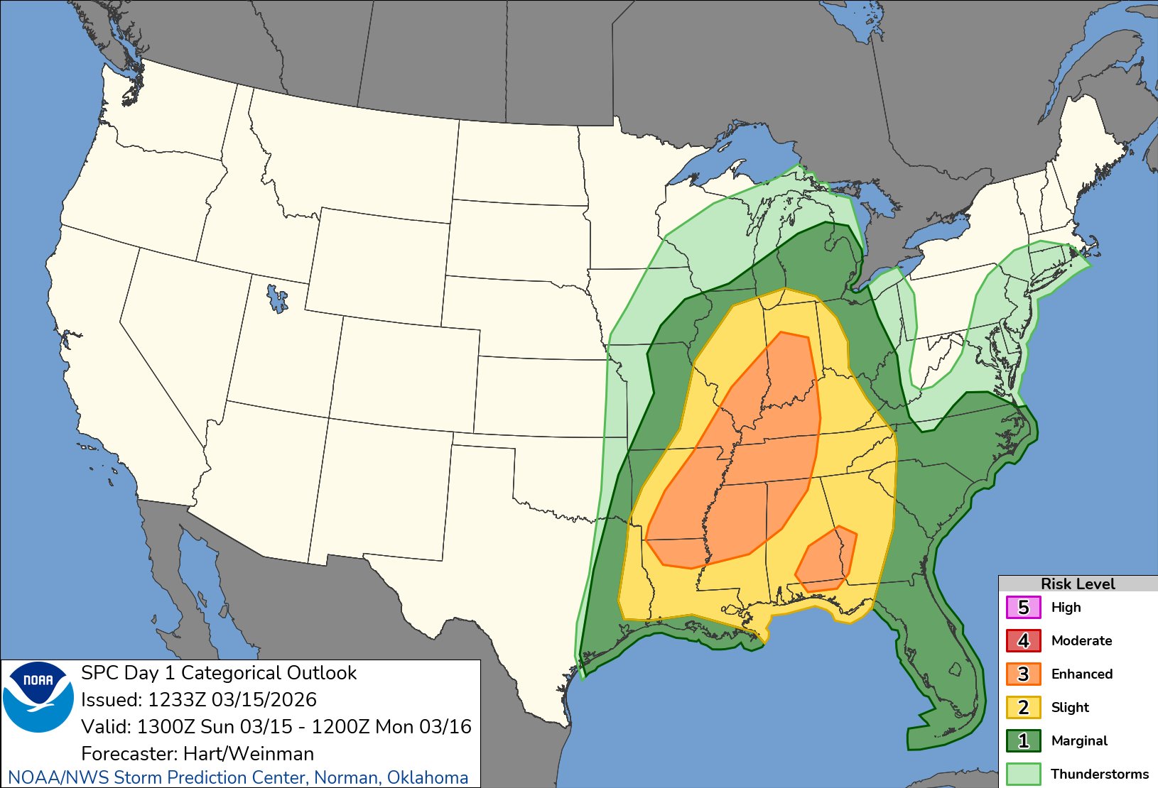
Here is the severe weather outlook for today.

Map showing the SPC Day 1 Categorical Outlook for severe weather risk levels across the southeastern United States, with areas shaded in varying colors indicating different risk categories from marginal to high.

Here’s the timeline for severe storms from today into tomorrow:

A weather map indicating severe storm risk across the United States for March 15-16, with color-coded areas showing varying levels of risk, from marginal to high. The map includes timing estimates for storm formation and potential hazards like damaging winds and tornadoes.

The tornado outlook shows a 10% chance (that is high) for discrete supercells.

Map showing the SPC Day 1 Tornado Outlook for the southeastern United States, including areas with varying probabilities of tornado occurrence, dated March 15, 2026.

The storm threat moves east tonight and tomorrow with an even greater risk.

Severe weather outlook map for March 16, 2026, showing risk areas across the eastern United States with varying severity levels indicated by colors.

Large hail, severe wind and tornadoes are in the forecast tomorrow, too.

The worst will be from the Carolinas to the Mid Atlantic.

The storm is beginning to take shape over MO and AR right now with a squall line developing.

Weather map showing various precipitation patterns across the United States, with snow in the northern regions and rain in the southern regions.

I’ll have more updates on the severe weather threat coming up soon.

Thank You,

Jason

Leave a Reply

Accurate, Relatable, Straightforward Weather

Discover more from Jason Nappi Weather

Subscribe now to keep reading and get access to the full archive.

Continue reading